Ocean Launched hurricane research drone
Storm
surfer
Autonomous hurricane research
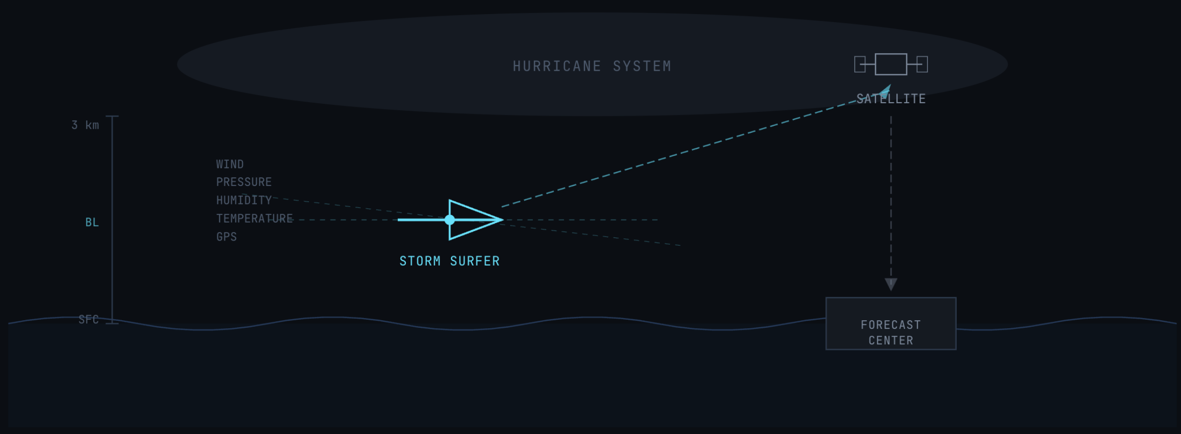
Ocean-launched autonomous drone that pre-position along hurricane tracks and fly into the storm boundary layer, delivering real-time wind, pressure, and humidity data to improve intensity forecasts.Ocean-launched autonomous drone that pre-position along hurricane tracks and fly into the storm boundary layer, delivering real-time wind, pressure, and humidity data to improve intensity forecasts.
Altitude
0 – 3 km boundary layer
Launch
Pre-positioned ocean tubes
Data
Wind, Pressure, Humidity, Temp
01 — The Problem
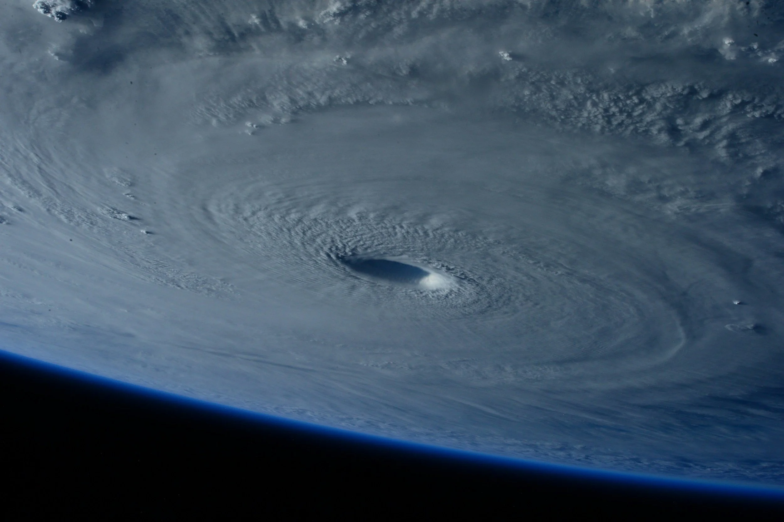
The Hurricane Boundary Layer Is Undersampled
Hurricane intensity forecasts have improved only modestly over the past two decades compared to track forecasts. The primary bottleneck is a lack of persistent, dense observations inside the 0–3 km storm boundary layer — the critical zone where ocean energy transfers into the storm, where rapid intensification originates, and where the most destructive winds exist.
Current observing systems were not designed for continuous boundary layer sampling. Satellites see cloud tops, not the surface. Hurricane Hunter aircraft deliver excellent but sparse profiles during 8–10 hour flights. Dropsondes provide snapshots on descent. Surface buoys are fixed and widely spaced.
The result: operational models lack the data density needed to capture rapid intensification events — the single largest source of hurricane forecast error and the scenario most dangerous to coastal populations.
02 — The Concept
Pre-Positioned in the Ocean. Launched Into the Eyewall.
Storm Surfer combines ocean engineering, solid-fuel rocketry, and autonomous flight in a single expendable platform. Deployed months before hurricane season, launched on command when a storm threatens.
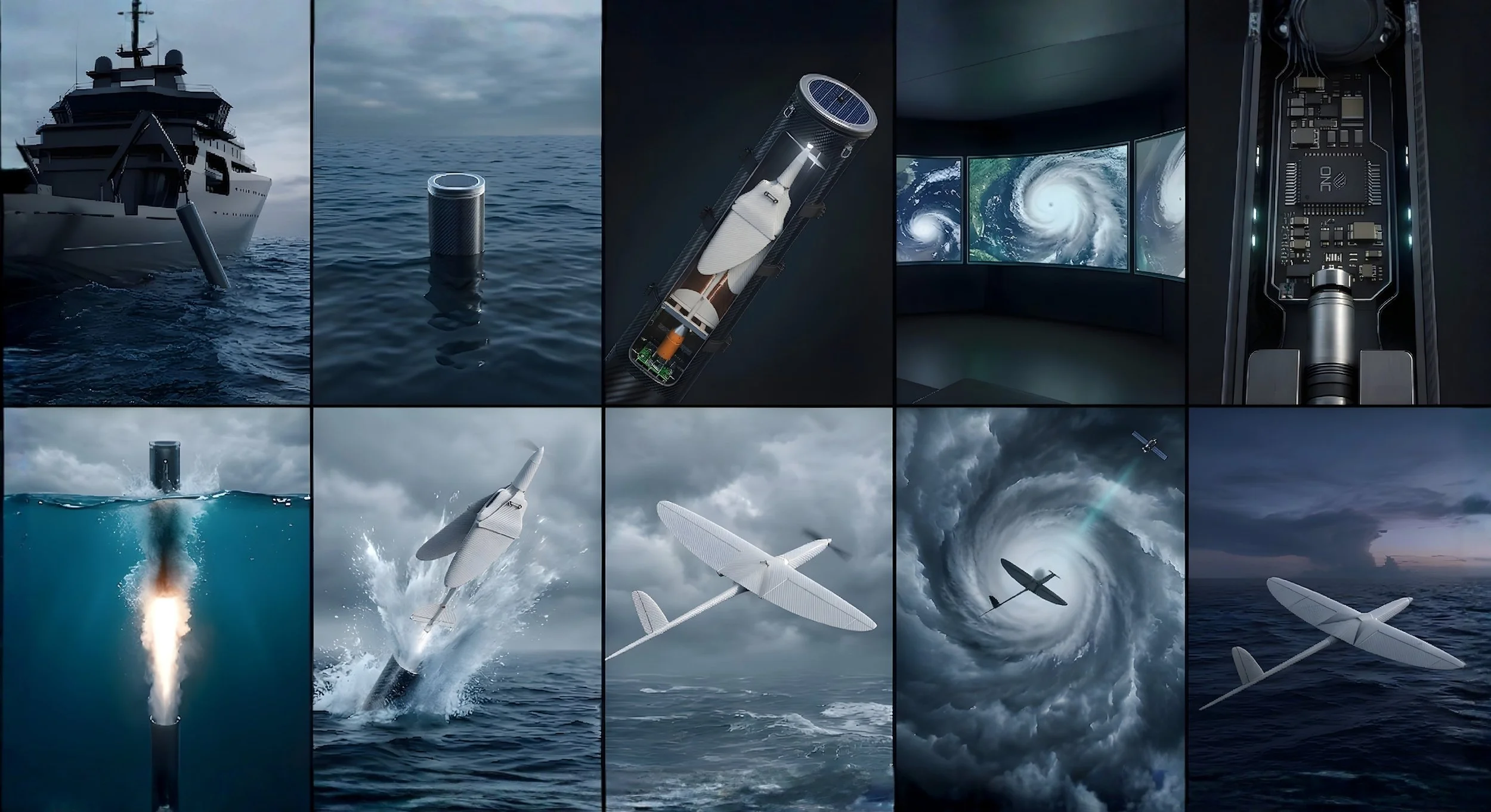
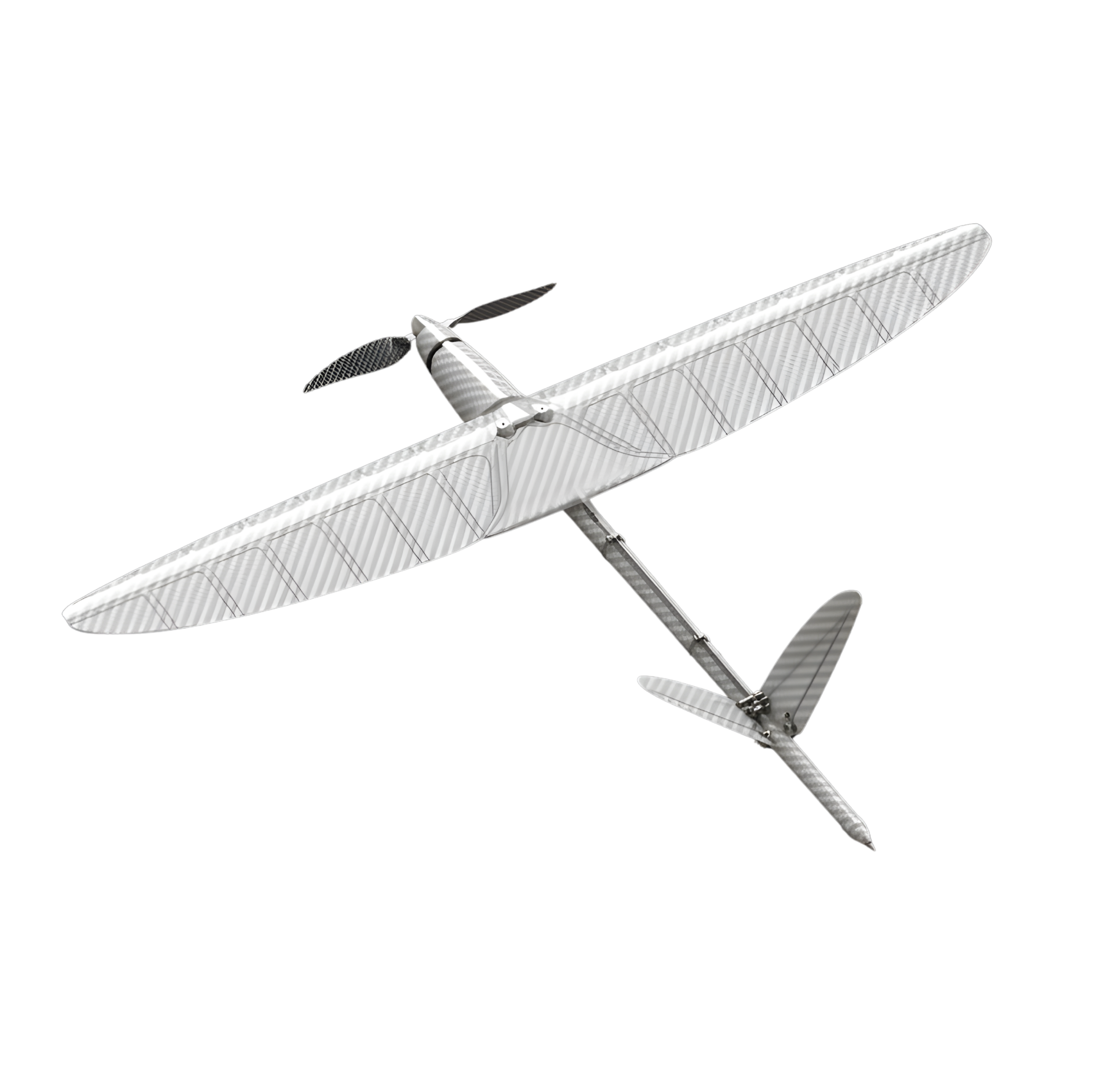
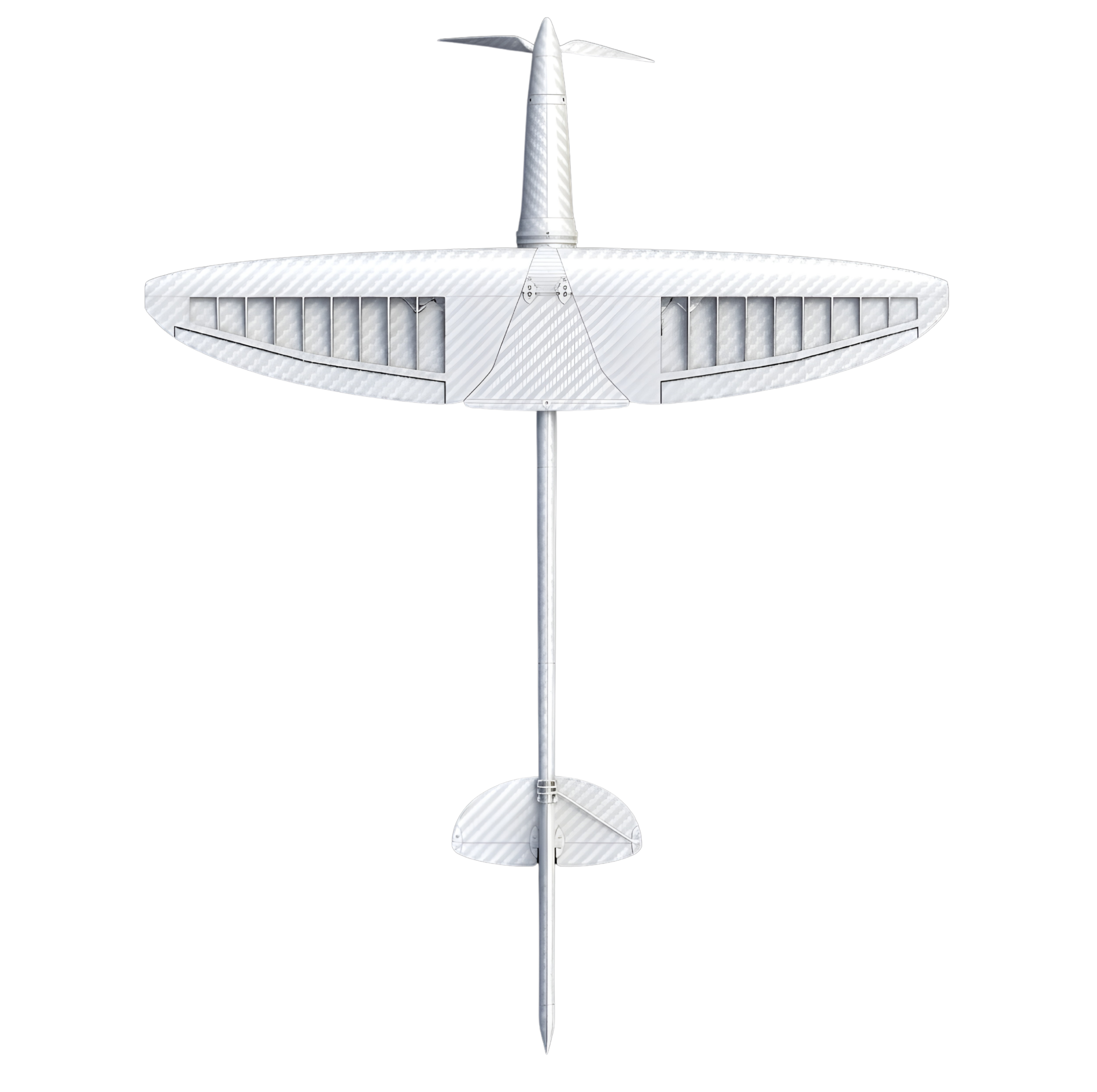
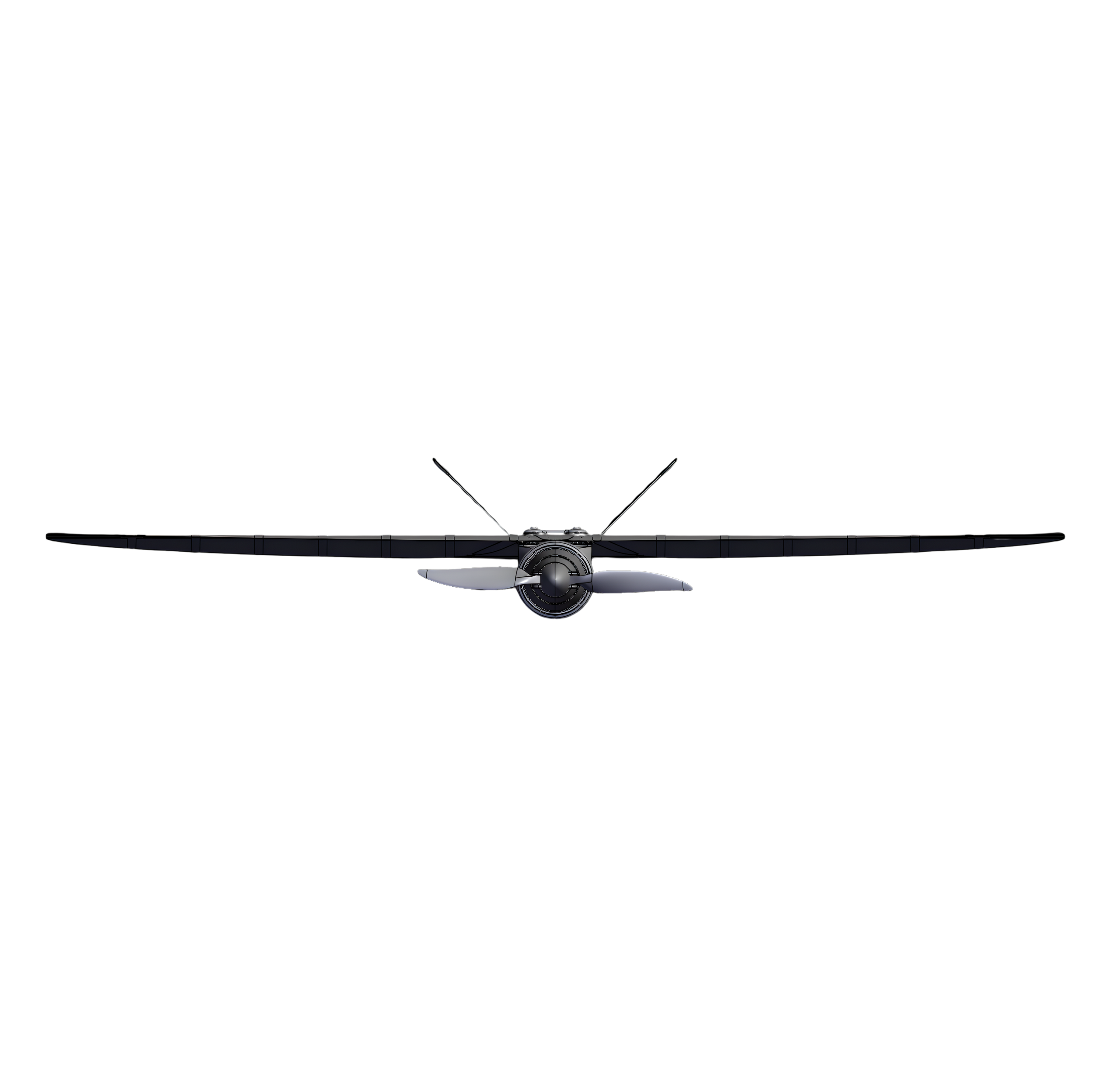
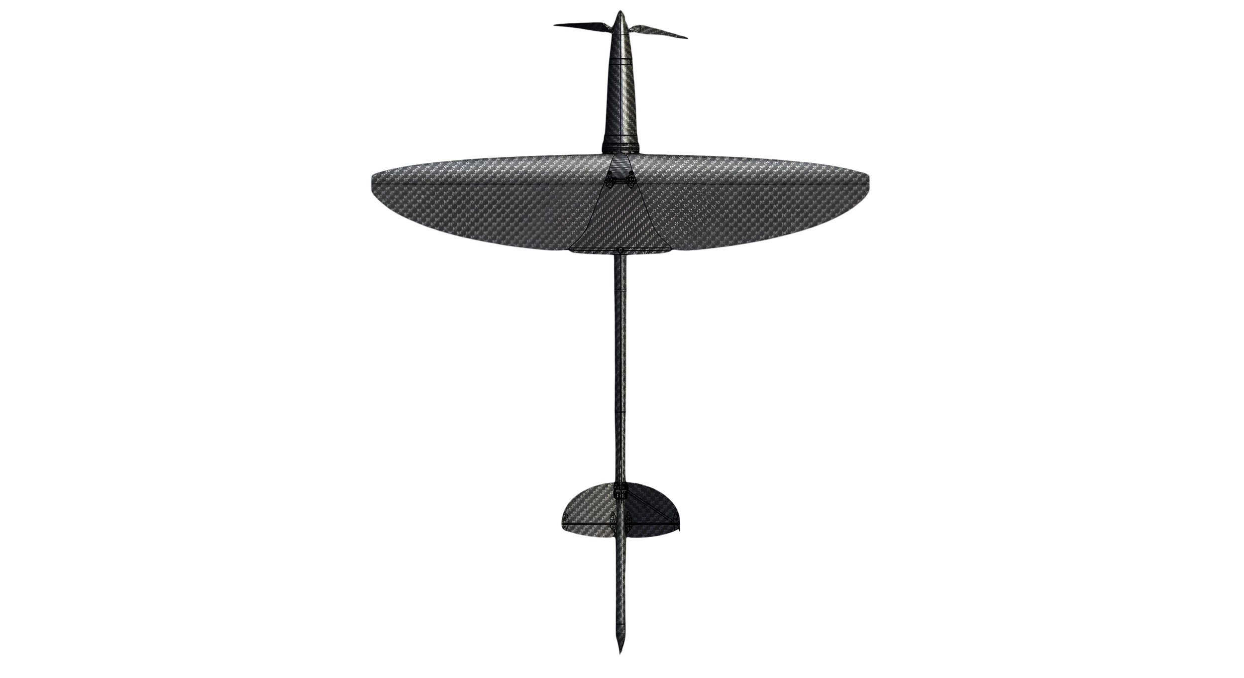
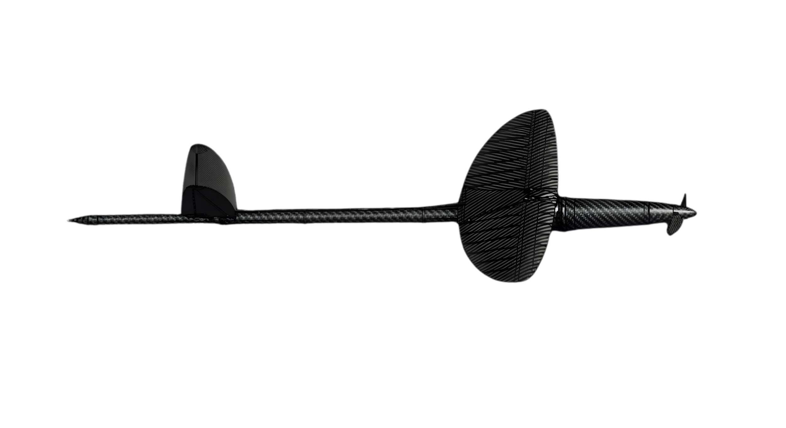
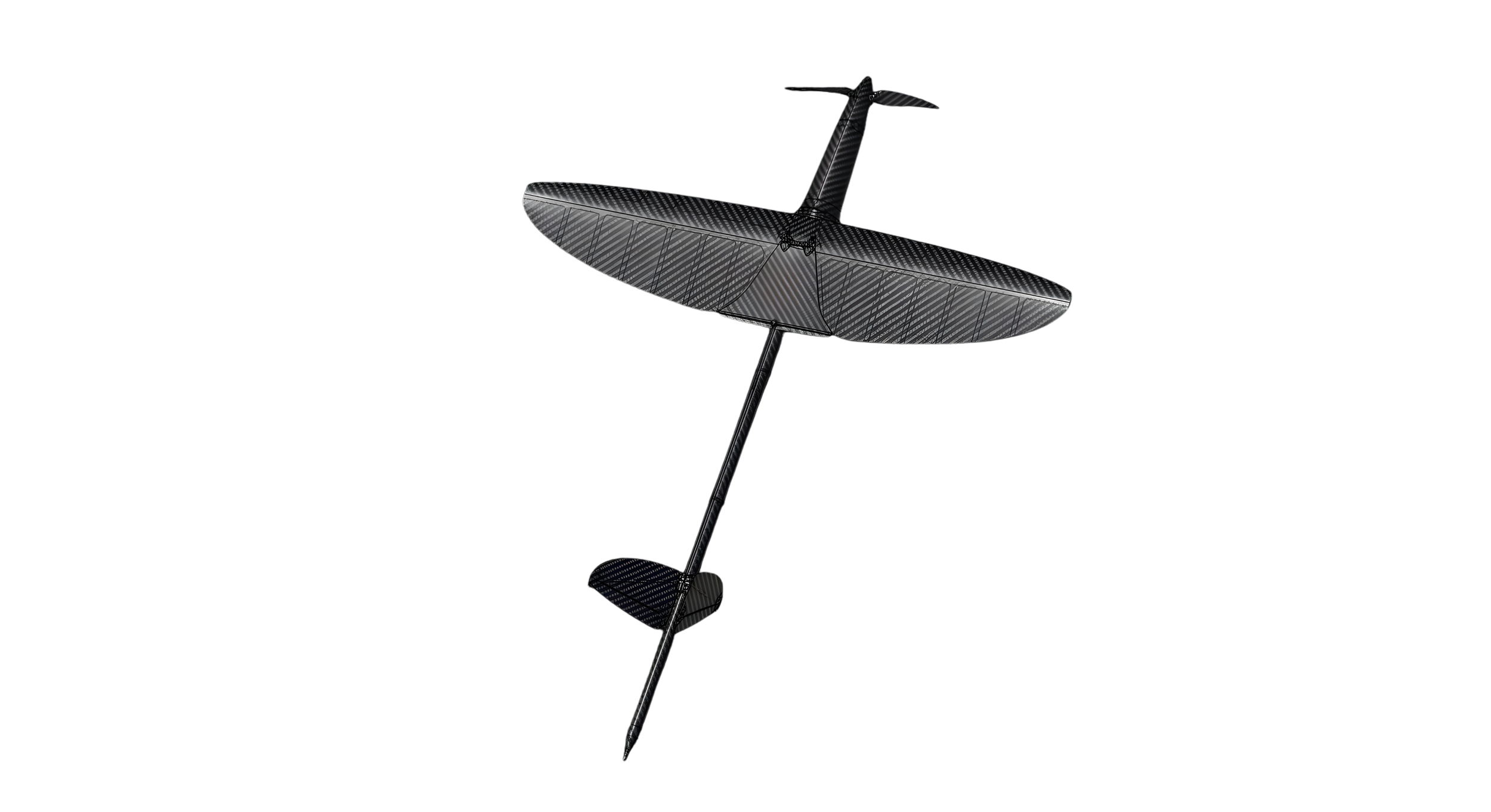
03 — The Airframe
A Flying Blade Built to rip through Storms
Carbon fiber composite construction. Folding wing for tube storage. Designed to survive sustained hurricane-force winds and torrential rain in the lower storm boundary layer.
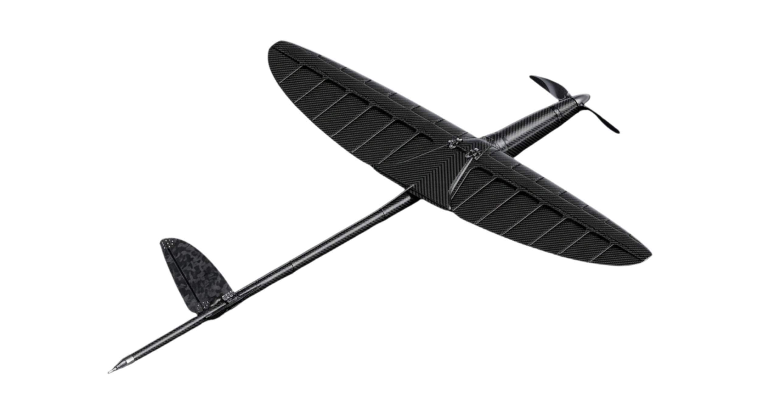
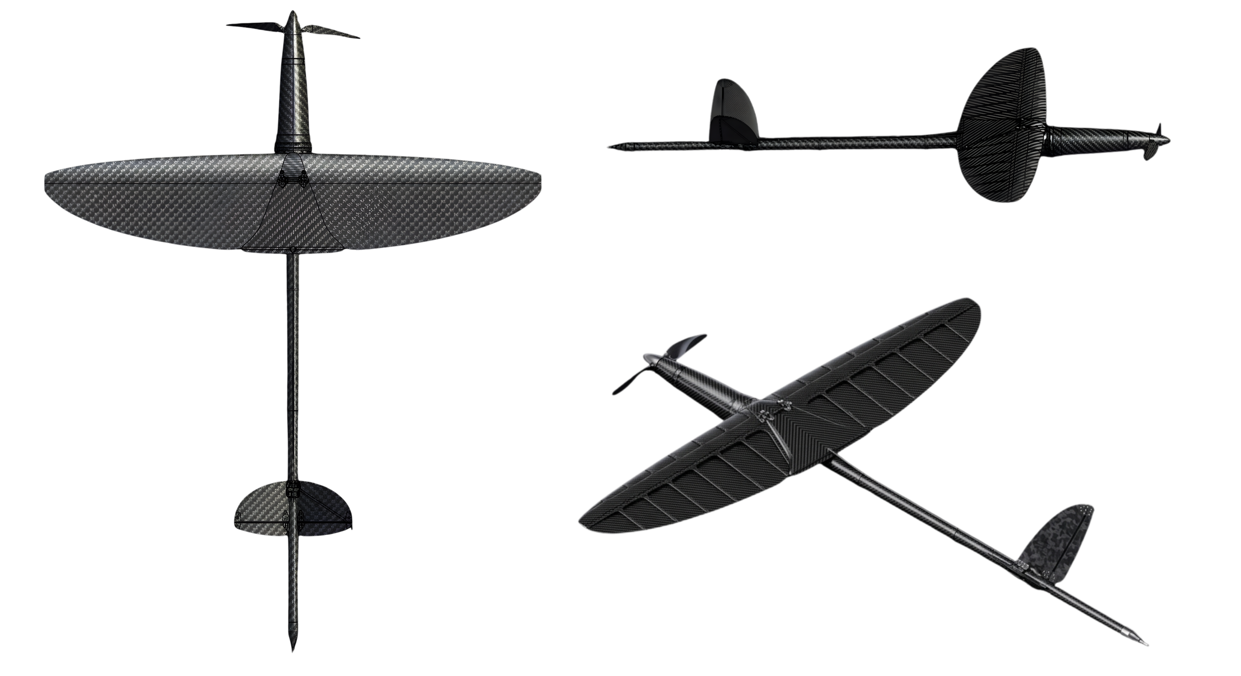
SPECS
Wingspan: ~1.2 – 1.5 m
Length: 0.8 – 1.0 m
Mass Class: <3 kg (expendable)
Max design wind: >80 kt sustained
Cruise speed: 25 – 45 m/s
Mission duration: 2 hours
Comms link: Iridium SBD / L-band
04 — Sensors & Data
In-Storm Measurements That Matter
Every sensor is selected for its ability to constrain the thermodynamic and kinematic structure of the hurricane boundary layer, directly feeding into operational forecast models.
3D Wind Vector
Multi-hole probe and IMU fusion for full 3-component wind at flight level. Constrains boundary layer inflow, convergence patterns, and low-level jet structure critical for intensity prediction.
Humidity
Boundary layer moisture profiles constrain surface evaporation rates, moist static energy budgets, and convective potential all key drivers of rapid intensification.
Pressure
High-precision barometric pressure for central pressure estimation and radial pressure gradient profiling. Direct input for HWRF, HAFS, and other operational models.
GPS Position & Timing
Precise geolocation and timing for every observation. Enables data assimilation into numerical weather prediction models with correct spatial and temporal attribution.
Temperature
Fast-response temperature for boundary layer thermal structure, warm core identification, and air-sea temperature difference calculations that drive enthalpy flux.
Microphysics
Future payload slot for optical particle counters, sea spray sensors, or aerosol instruments to study microphysical processes that affect storm intensification.
05 — Mission Profiles
Designed for Real NOAA Operations
Each mission profile is tailored to fill a specific operational gap in NOAA's current hurricane observing strategy.
Pre-Landfall Intensity & RI
Swarm of drones launched 24–48 hours before landfall
Continuous boundary layer profiling during rapid intensification
Direct data feed to NHC intensity models and advisories
Coordinated P-3 / G-IV Flights
Storm Surfer under-flies NOAA aircraft to provide stacked vertical profiles
Boundary layer data paired with mid-to-upper level aircraft measurements
Bridges the altitude gap between dropsondes and surface buoys
Multi-Day Open Ocean Sampling
Pre-positioned tubes along climatological tracks for continuous sampling
Captures boundary layer evolution over multiple days of storm development
Data available where aircraft cannot maintain continuous presence
Post-Landfall Rainfall & Surge
Rides the decaying storm over water and into near-coastal environments
Low-level wind and moisture data for storm surge and rainfall forecasts
Extends observing window into regions too dangerous for manned aircraft
06 — Fleet Architecture
A Field of Silent Launch Tubes
Dozens of autonomous launch tubes deployed across the open ocean, waiting silently for a storm to approach. Each one a loaded weapon against forecasting uncertainty.
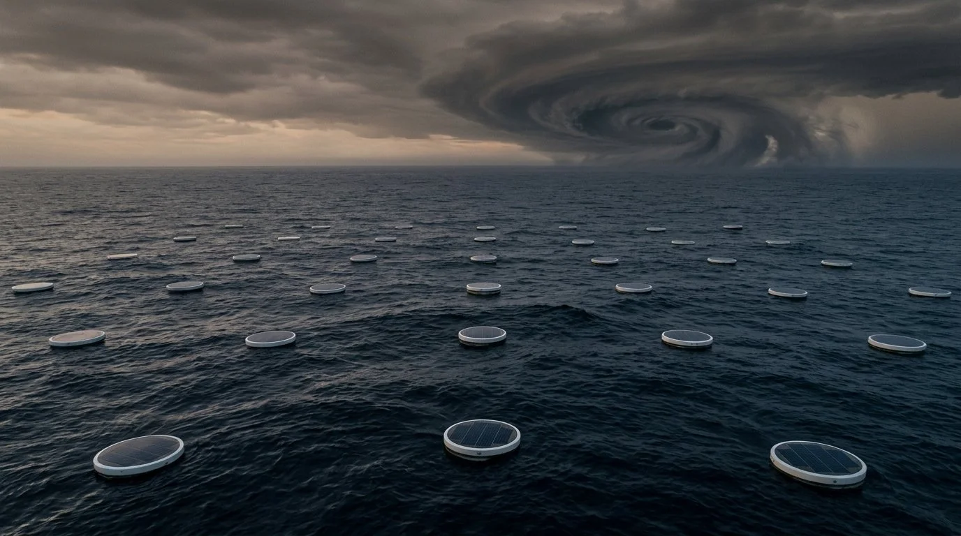
Seasonal Deployment
Tubes are deployed pre-season by research or charter vessels along statistically likely hurricane tracks. Each tube is designed to survive months of open-ocean conditions including moderate seas, marine growth, and UV exposure.
Regional Coverage
Initial deployments target the main development region (MDR) and the Gulf of Mexico approaches. Tube spacing is optimized for 50–100 km grid resolution with adjustable density along high-probability tracks.
Ocean Survivability
Marine-grade construction rated for Sea State 6. The solar charging lid doubles as a wave-breaking cap. Internal ballast ensures the tube remains vertical and stable through normal sea states while waiting for mission activation.
07 — For NOAA & Government
A Tool Built for Your most important Missions
Boundary Layer Data at Scale
Addresses the core observational gap identified by NOAA's Hurricane Forecast Improvement Program: persistent, dense measurements in the 0–3 km layer during the most critical periods of storm evolution.
SBIR & Pilot Program Ready
Designed for phased development and testing through NOAA SBIR, with clear milestones from lab prototype to field demonstration to limited operational deployment.
Joint Field Campaigns
Available for coordinated experiments with NOAA's Hurricane Research Division, collaborating alongside P-3 and G-IV missions for comprehensive multi-platform datasets.
Model Integration
Data formatted for direct assimilation into HWRF, HAFS, and next-generation models. Standard BUFR/NetCDF output compatible with existing NOAA data workflows.